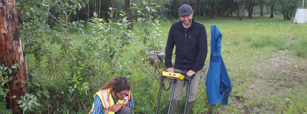
We used ground-penetrating radar to search for unmarked gravesites at a potential development site in Fort Simpson.
Client Name
Government of the Northwest Territories
Services Provided
We provided site assessment with ground-penetrating radar, an assessment of the data by a qualified archaeologist, a written report, assistance in public consultation, a surface survey for project relocation, and fencing.
Client Challenge
Locals informed our client that unmarked graves likely existed at a planned development site, which was adjacent to old graveyards. The client needed to assess the possibility before proceeding.
How B&B Solved it?
Ground-penetrating radar was conducted around the areas of two old graveyards in Fort Simpson, where the government of the Northwest Territories was proposing to develop a maintenance shop and housing. Anomalies that could be burials were found. We provided images and written interpretation of the subsurface images to the client, as well as support during public meetings in the form of providing information and answering questions. We gave on-site direction to surveyors for the relocation of the developments, and we fenced off the area.