Every time I travel to communities in the North to teach the Environmental Monitor Training Program or other community-based monitoring programs, I am always asked two things: first, where did I get the local topo maps from, and second, can I give them to you? Well here you go. I am about to show you how to get the print-ready PDF versions of the maps that I use in these classes.
Before we start, there are a few things you need to know about the maps you want.
First, what scale of map do you need? In the National Topographic Series, there are two common scales for use:
- 1:50,000 These maps are the most zoomed-in you can get in Canada; they have the highest level of detail and are great for short trips.
- 1:250,000 This is the classic zoomed-out map where each grid square measures 10 km x 10 km. These are good if you are travelling longer distances so you don’t have to carry as many sheets with you. Unfortunately, you do lose some detail relative to the 1:50,000-scale maps.
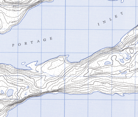
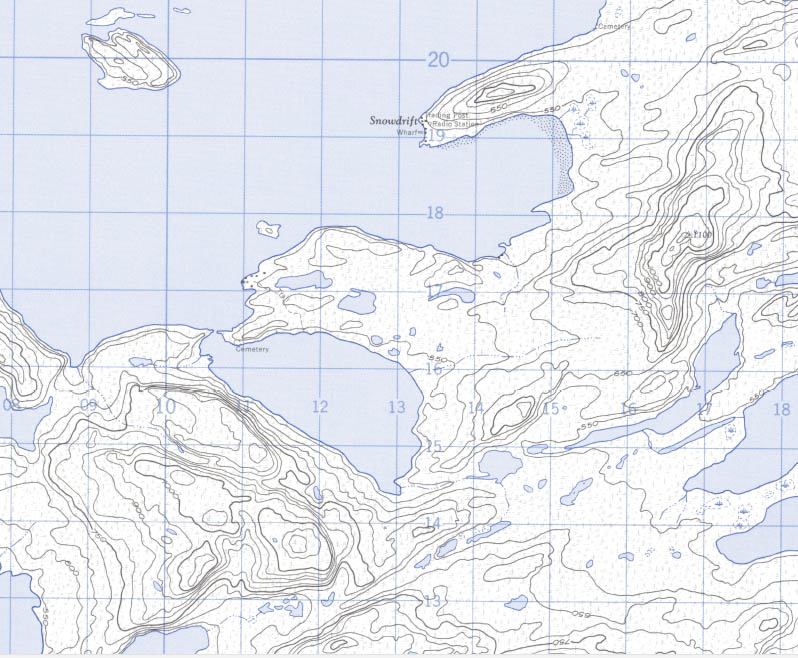
Example of 1:50,000 scale map
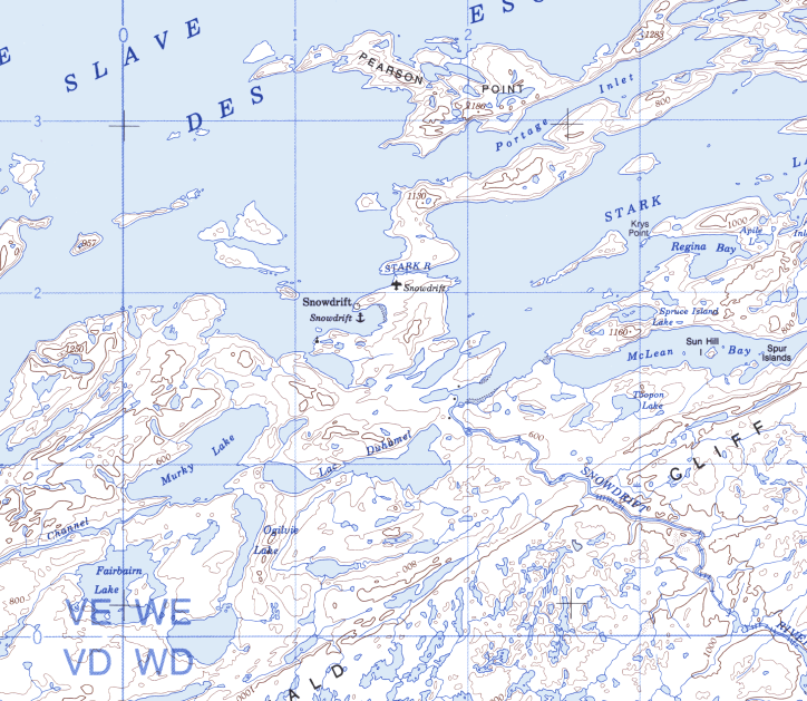
Example of a 1:250,000-scale map of the same area. Note the loss of detail.
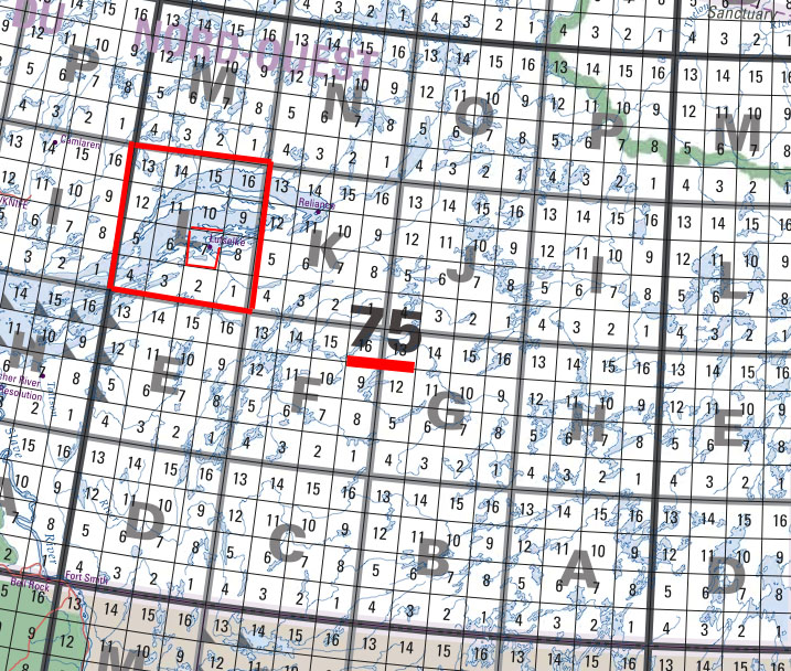
Second, you need to know what the map sheet number is of the map you would like to print.
To find your map sheet number, use the NRCAN NTS index map (found here) and look up your number. For the purposes of this tutorial, I’m using the index map for northern Canada. For this example, we will use the community of Lutsel K’e. Both the 1:50,000 and 1:250,000 map sheet numbers are on the same index map. The 1:250,000 maps end with a letter representing a large map-grid area, whereas the 1:50,000 has the letter and ends with a number representing a numbered subsection of that map-grid area. There are 16 numbered subsections in each lettered map-grid area.
So for Lutsel K’e, the 1:250,000 map sheet is 75L, while the 1:50,000 map sheet is 75L7.
Now that we know the map sheet number, all we need to do is go to the NRCAN FTP site and select either 250k_pdf or 50k_pdf depending on which scale of map you are looking for. First lets find the 1:50,000 map. So, select 50k_pdf and find the initial number in the map sheet number we want, which in this case is 75. Select 75, and look for the letter L; click on that. In the new folder that opens up, it becomes slightly more complicated. Look for the map sheet number in the file name; in this example, the website’s use of lowercase letters can be confusing, as the letter “L” looks a bit like a “1”. I’ve attached a picture below of the file we want underlined in red for clarity.
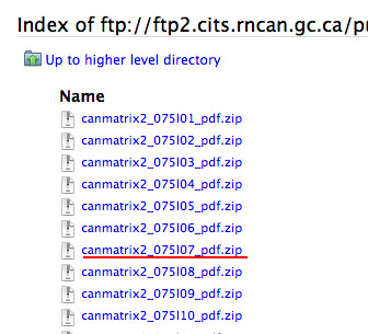
The underlined file is the one we are looking for
Next, download the file. Unzip it and open the PDF file inside the folder. This PDF is ready to be printed in large map format. Now you need to go find yourself a large printer (or a plotter). This may in fact be the hardest part. In Fort Smith, I use the one at Cascade Graphics for a small fee. In the more remote communities, you may have to go to the hamlet office or the school to find one.
And here you go, a nice screen shot of Lutsel K’e
And there you have it. No need to order them from down south and wait weeks on end for them to show up, if they even have the map you need. Also, they are doing the same thing I just showed you and charging you a bundle for something you can just do yourself.
If you have any questions, let me know and I’ll help you out.
-John
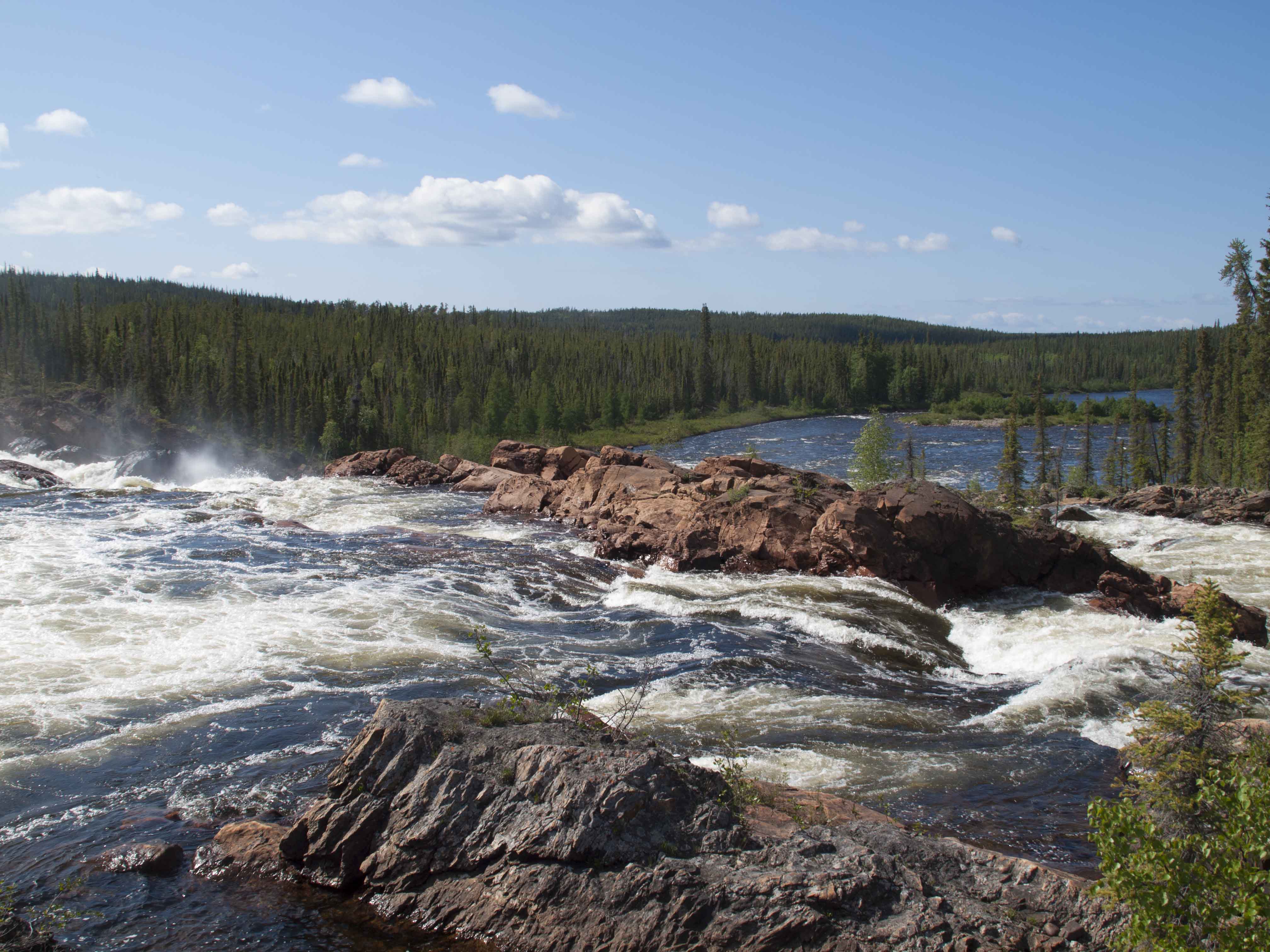
A scenic set of falls on the Snowdrift River